As turbulence worsens, SkyPath chief executive Maya Shpak explains how pilots' iPads, machine learning, and a strict data-sharing rule combine to give crews about 10 minutes' warning.

Clear-air turbulence is the hazard pilots cannot see coming. It strikes in cloudless skies, often at cruising altitude, and is invisible to an aircraft's weather radar, which detects moisture rather than moving air.
Asked whether the turbulence that hit a recent Air India flight could have been flagged by SkyPath's system or was the kind nobody sees coming, Chief Executive Officer Maya Shpak was clear: “So to [answer] your question, without referring to a specific case whose details I’m not familiar with, Clear Air Turbulence is visible to the SkyPath system”
SkyPath flags all kinds of turbulence, she says, whether convective (from storms), mountain wave (where wind flows over high terrain), or clear-air turbulence (CAT). Alerting on CAT, which is "usually unseen in radar or in the weather models" and typically does the most damage, is what sets the company apart. "We are not a weather provider," she adds.
A growing problem
Shpak describes a general increase across light, moderate, and severe turbulence and, citing industry research, a 55% rise over the US in the past 40 years. More flights and flights into newer regions mean more severe encounters. Severe turbulence remains a small share, but even moderate turbulence can cause damage if passengers and crew are unbelted and unprepared.
Climate change contributes, she says, though it is challenging to quantify it. So does El Niño, the periodic Pacific warming that disrupts weather worldwide, which she says is shaping up to be one of the worst "in the last, hundreds of years". Its effect shows mostly over Asia-Pacific (APAC) and the US, "but not only". APAC, the US and, at times, the Atlantic are the regions she considers most prone.
Every aircraft as a sensor
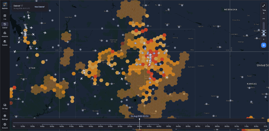
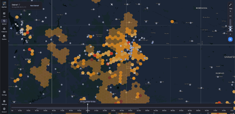
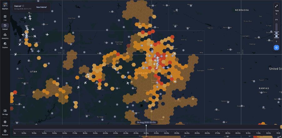
It starts with crowdsourcing. Many pilots use an iPad as an electronic flight bag (EFB), the tablet that replaced paper charts and manuals. With SkyPath installed, every aircraft and its iPad become a sensor, or "a reporting machine", much as Waze or Google Maps crowdsource traffic jams from drivers' phones. The more users, the more accurate the picture.
A machine-learning model then uses more than 200 weather parameters to predict turbulence where there are no iPad reports, with reports fed back in a closed loop that Shpak says delivers 90% accuracy. "It's not a weather model," she says. "It's a machine-learning model."
A further layer adds pilot reports (PIREPs); eddy dissipation rate (EDR), an objective, aircraft-independent measure of turbulence intensity; and turbulence derived from ADS-B, the position and altitude data aircraft broadcast automatically. Everything is meshed into one picture, available in SkyPath's own app or through partner EFB and flight-following tools.
Ten minutes' warning
Before departure, the pilot loads the route, sees "five different factors of turbulence combined together" and briefs the crew. About 10 minutes before moderate-or-greater turbulence, a "verbal and a visual notification" pops up, like a text message. Opening it shows when and where the turbulence was reported – and whether it poses a risk to the aircraft on its flight path.
The pilot can then have passengers fasten seatbelts, seat the cabin crew, or, if it is severe, reroute to avoid it.
Even more important, Shpak argues, is "validated smooth air": the system also records where there is no turbulence, giving pilots confidence when changing altitude and letting crews plan cabin service. Fly with one of the airlines using our service, she says, and you may hear that turbulence is 10 minutes away but, until then, drinks will be served and passengers can use the restroom. Showing where the air is smooth, she adds, builds loyalty and reputation.
Under a minute
With onboard Wi-Fi, which not every aircraft has, reports reach the following aircraft in under a minute, using only minimal amounts of data: if someone hit turbulence two minutes ahead of you, you will know. Without it, the airline's dispatchers, the ground staff who follow each flight, are alerted and will notify the air crews when needed, Shpak noted.
No sharing, no deal
Because SkyPath's network spans competing airlines, data sharing "was a challenge in the early days". Reports are anonymized and merged with others from the same patch of sky, so the system is "agnostic to whoever reported it". Airlines gradually saw the value of data as the technology was adopted more and more.
Reports versus forecasts
Busy airspace yields denser, better-validated data, but SkyPath still commits to 90% accuracy where it relies on forecasts. Trusting a report over a forecast is "more of a psychological element", Shpak says, because someone actually felt it; The US and the Atlantic, where SkyPath has many users, are its strongest regions. Elsewhere, she says, the need is "better market education," so airlines trust a forecast offering 100% global coverage.
Nor is the system "100% bulletproof". At the beginning, its forecast models did not account for abnormal weather, SkyPath's latest model uses short-burst training, so an anomaly missed one day is absorbed and the next day's forecast is accurate again: adjustments that, she says, “took months on our models” and years in traditional forecasting.
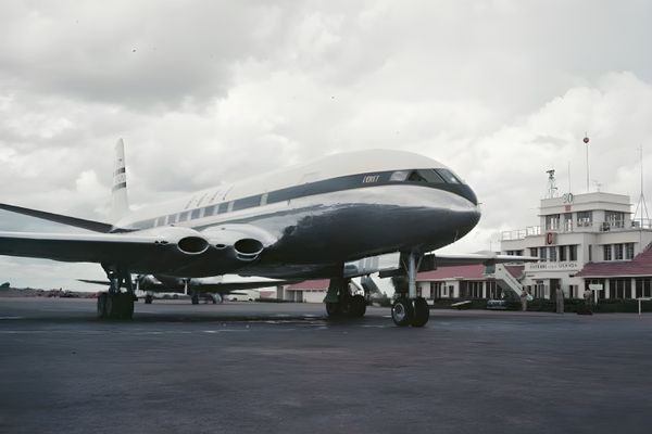
The Shape of Disaster: The Plane That Kept Falling Apart Mid-Air
Proving a negative
Can SkyPath prove it prevented anything? "Yes and no," Shpak says. Drawing on nine billion data points a year, it sees a 50% reduction in moderate and severe turbulence encounters among customers, through rerouting or better route planning, even as atmospheric turbulence rises. "I'm talking about encounters, not incidents," flights through rough air, not injury-causing events.
Looking back at almost 200 incidents from roughly the past year, SkyPath found it had relevant data available beforehand in 78% of cases. That doesn’t mean all of those incidents could have been prevented by a route or altitude change, Shpak says, but the information could give crews more time to prepare the passengers, secure the cabin, and prevent injuries.
For Shpak, measurement is the point: validating and quantifying impact links technology directly to return on investment. "I'm a great believer … in numbers," she says. Numbers always speak for themselves, she adds.
FAA Plans to Retire Floppy Disks from Air Traffic Control Systems by 2028 » FAA Orders Fuel Tank Inspections on 60 US Boeing 787s Over Lightning Ignition Risk » British Airways Returns to Dubai After Eight-Month Pause Tied to Iran Conflict »
Comments (0)
Add Your Comment
TAGS
STORIES SkyPath Maya Shpak Turbulence Clear-air turbulence Hazard Turbulence Safety Rising Turbulence CAT Convective Turbulence WeatherRECENTLY PUBLISHED
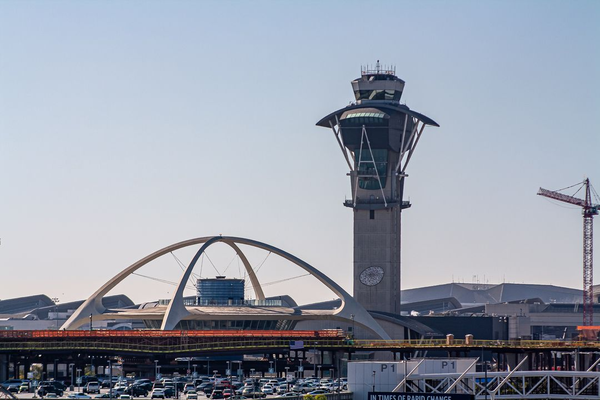 FAA Plans to Retire Floppy Disks from Air Traffic Control Systems by 2028
The FAA plans to replace floppy disks and other aging technology used in US air traffic control facilities, with a full rollout targeted by 2028.
NEWS
READ MORE »
 NTSB Recovers Cockpit Voice Recorder from Deadly Florida Learjet Crash
Investigators retrieved the cockpit voice recorder from a Learjet 60 that crashed in Greenacres, Florida, killing those on board.
NEWS
READ MORE »
 Geneva Prepares for Its First Direct Flight to South America in 2027
LATAM Airlines will launch a nonstop route between Geneva and São Paulo in the second quarter of 2027, marking a first for the Swiss airport.
NEWS
READ MORE »
More than just headlines.
Get unlimited ad-free access to in-depth aviation news, premium stories, and exclusive insights other sites don't cover.
- Ad-free browsing on AeroXplorer
- Unlimited access to premium and exclusive articles
- Higher photo upload limits & commissions on sales
- Free access to Jetstream Magazine on higher tiers
- Ad-free browsing
- Sell aviation photos with 60% commission
- First week free!
- Everything in Basic+
- Unlimited premium articles
- Sell aviation photos with 70% commission
- Free Digital subscription to Jetstream Magazine
- First week free!
- Everything in Basic+ and Pro
- Sell aviaiton photos with 80% commission
- Early access to exclusive stories
- Free Digital+Print subscription to Jetstream Magazine